Training
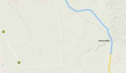
I have a last week of holidays which I hope to use for a 6 day ride. I thought some longer rides would be good preparation, so last week I took two 170km rides which were rather different. In the graphic below you can see the (blue) altitude profile of a day trip to Balaklava. It's rather easier than the trip to Sedan!
Balaklava is north of Elizab eth and prime grain growing country. These folk look set for a good harvest, whereas some crops out east of the Mt Lofty Range were thin and patchy.
My ride took me past "Max and Mel's Paddock."
It's near where Max Fatchen lived— my Dad enjoyed his columns. They were of an age and died only a few months apart. I often look at this paddock and think of talking crops with Dad. It's a good crop this year.
The route to Balaklava shows how you can avoid much of the highway traffic by using secondary roads. (Link to KML) It is a fast ride, even for me. 175 kilometers at 23kph despite nasty cross winds for most of the trip.


I sat outside a bakery in Balaklava for lunch observing the toys in the front window of the newsagent. No Tonka trucks here. Instead, enough tractors to stock the Yorke Peninsula field days, several brands of Header, toy chainsaws and whipper snippers. Only a farm kid would worry that his new tractor is pulling a tandem axle trailer, as opposed to some other sort! It's a farming town through and through!
I was struck again by the amazing courtesy of country drivers; semi-trailers slow down to wait for oncoming traffic, and the majority of cars move right into the other lane to overtake. It's a great ride for just clocking up kilometres and spinning out the legs.
The second trip was three days later, and I expected a rather slower time. The altitude profile increases from the Level 4 Tour de France equivalent of the Balaklava ride; ie, flat, up to Level 2.
The ride also has a significant metal road component through the Barossa High Country. These roads can be tricky to ride due to the gravel surface; it's like riding on marbles. (Link to KML)

This trip goes east from Elizabeth down onto the flat plains that roll across to the River Murray. The climate changes accordingly. The first challenge is getting over the shoulder of Mt Gawler to Kersbrook. The Hill peaks around 8% so it is not too hard, but is long. The climb essentially begins at our front door and continues from there, not the best morning warm up for old legs. I have always appreciated the rainwater tank at Kersbrook!
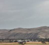
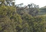
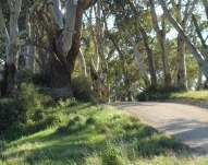
The Hills are only just beginning to dry out for summer. There is still plenty of roadside water, with ducks grazing in the open paddocks. The three photos below are taken within twenty kilometres of each other. The first is pasture land just 2 or three kilometres short of Mount Pleasant, dream country compared to my home patch.


Then, 6 or 7 kilometres east of Mount Pleasant, the drying effect near the edge of the range becomes apparent. The final photo is down off the range at Sanderston. They say the annual rainfall drops off an inch a mile as you go east from the range.
The view from the edge of the range is magnificent. How can you not love this country?
The ride north to Sedan goes through country settled by the early Lutherans in South Australia. Our sad World War One history is written into the landscape. Rhine Villa became Cambrai. The South Rhine became The Marne, and the North Rhine became The Somme River.


It's not far from Sedan that the road begins the climb into the high country on the Angaston Road. On October 10 the temperature on the road ranged from 35 to 40 degrees Celsius as I crawled up the slope. It is so rough here that early settlers fenced the road with stone walls instead of wire.
I took Cork Hill Road as a short cut through to Keyneton, the first taste of metal surface for the day. This is the best sort of gravel road at the moment; the stone is small and consistent in size and there are not too many hidden gutters full of the slush that can grab a front wheel and bring you down. But, as almost always with an unsealed surface, the ride is rougher and slow.


After Eden Valley the slow climb through the high country was mostly metal; Cranes Range Road, Craneford, High Eden Road, and Trial Hill. This is an easy road for slopes, with nothing much over 5%, but the surface is often slow and treacherous. There is not much corrugation at the moment, but the surface slush is often deep, with rocks up to 35 mils. It's very slow.


That said, the country is beautiful, with water and pasture to make a dry country farmer weep. I was a little too late to taste the wares at Mount Adam Winery.
Hitting the Jack Bobridge bike path after the big drop off Trial Hill was a delight. It's a fast ride back into Gawler, and the surface is a delight; I'd choose it over the road anytime. (176km at 19.3kmh)

Copyright ^Top


